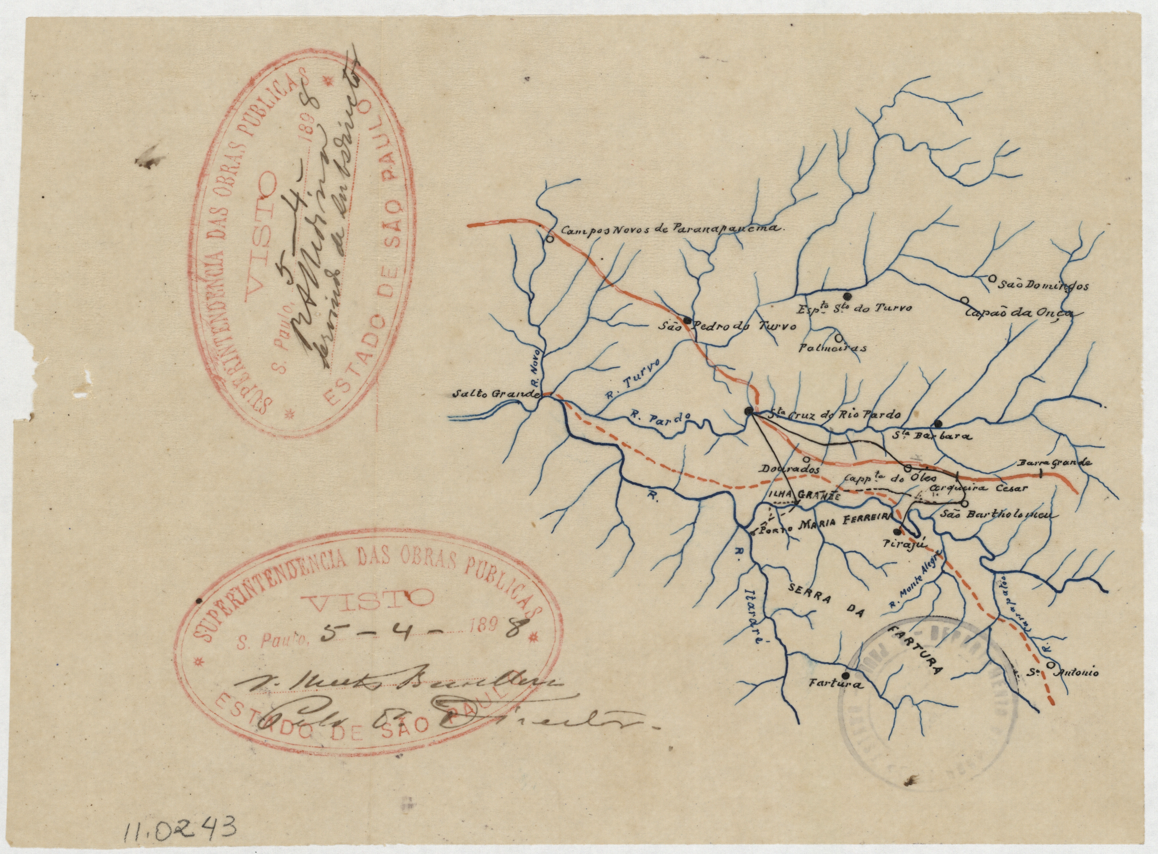
Jundiaí – Levantamento Aerofotogramétrico Cadastral – Foto_F06_118 Voltar 18 de junho de 2025 by Leticia Fachesi Carneiro Documento 1959_FOTO_F04_035 Baixar Metadados Miniatura Compartilhe TítuloJundiaí - Levantamento Aerofotogramétrico Cadastral - Foto_F06_118Data1983Palavra-Chaveaerofotogrametria | Companhia Paulista de Estradas de Ferro | Estrada de Ferro Sorocabana | horto florestal | planta cadastral | SP/JundiaíAcervoPMJ - Cartografia Histórica e GeodésiaLocalJundiaí Continuar navegando Jundiaí – Levantamento Aerofotogramétrico Cadastral – Foto_F05_088 Linhas Férreas e recursos hídricos – Região do Paranapanema Voltar para a lista de itens